If there’s a silver lining to these last few months, it may be this: People are discovering an outdoors they’ve previously experienced mostly through car windows.
The greater Wichita area boasts numerous scenic paths for biking and walking, and they’ve been packed as never before. For the most part, the region’s flat topography makes them ideal for all ages. Here are two great possibilities for your next outting.
Arkansas River Path great way to experience city
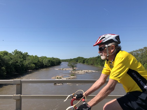
I’ve biked the Arkansas River Path so many times I could probably do it in my sleep — although that would not be safe. But seriously, what keeps me coming back? In addition to exercise, it’s a way to take in much of what makes Wichita unique in an hour or two, without fighting for road space with automobiles.
The path can be accessed from many points, but let’s consider it as if starting from its northern terminus, Big Arkansas River Park at 3900 W. 21st St. This part of the river features sandbars and much waterfowl, and the park has an informative display on the Big Ditch water diversion project and the man who created it, Mitch “Big Ditch” Mitchell. Heading south and east along the river, the path travels under bridges on Amidon Street and 13th street.
Here the path splits – one side winding along the west bank of the river, adjacent to McClean Boulevard, and the other hugging the east bank, skirting close by Sim Park and Old Cowtown Museum’s frontier era buildings. Short spurs will take you to Botanica, the Wichita Art Museum and Riverside Park, and bridges at Central and Seneca allow you to cross the river. To avoid vehicle traffic altogether in this area, take the west bank path, which passes under Seneca.
Paths on both banks of the river continue past the Mid-America All-Indian Center and the towering Keeper of the Plains sculpture and plaza, always worth an appreciative pause. The east bank offers access to Veterans Memorial Park with its numerous monuments, while the west side passes through the Exploration Place grounds (a short diversion uphill leads to the city’s new main library).
The dual paths continue to roll on through downtown. On the west you’ll find new riverfront apartments, the new minor-league baseball stadium and easy access to the Delano shopping and dining area centered along Douglas. The east path zooms by the historic Broadview Hotel, Century II, the Hyatt’s water fountain wall and Wichita Boathouse. Turn east at the 1st Street bridge and it’s a quick five-minute ride along a marked lane to the Old Town entertainment district.
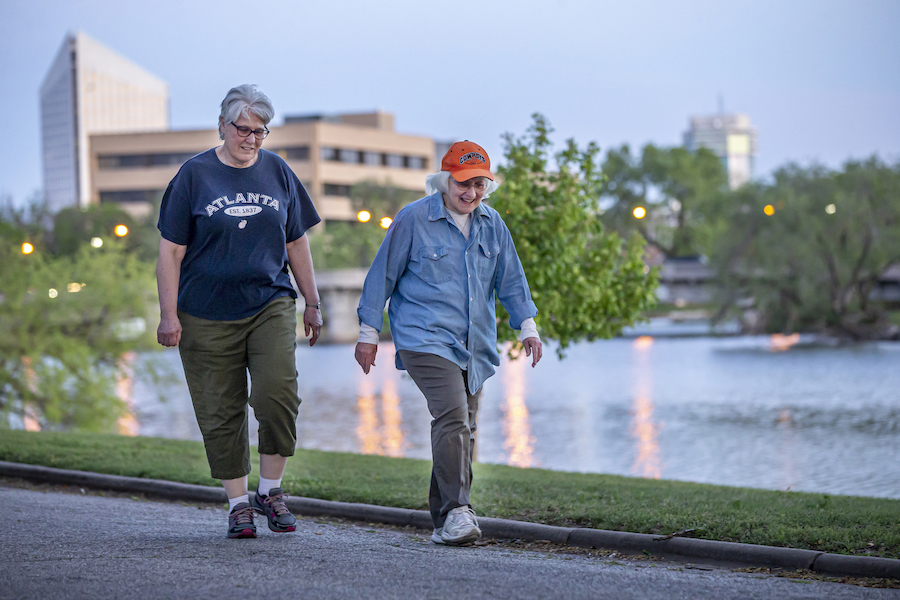
This part of the river is busier than ever before. Expect to find walkers, skateboarders, sunbathers, fishermen, boaters, sweethearts and more.
From downtown, paths follow both sides of the river south to Lincoln Street, where there’s a bridge, dam and fish ladder (I’ve never seen any fish actually use this ladder, but the number of fishermen in this area make me think they do). Take a second here to look back north. It’s one of the prettiest views available of downtown. The east-side path ends just south of Lincoln Street, connecting there with another path that runs east along railroad tracks to the Kansas Firefighters Museum on south Broadway (you must cross Market, Main and several more streets to get there).
If you want to continue south — and I recommend it — cross to the west bank at Lincoln. You’ll pass Harry (where there’s a new bridge under construction) and Pawnee before reaching O.J. Watson Park with its ponies, miniature train, fishing and sand volleyball courts. Cross the river again at the John Mack Bridge (second largest concrete bridge of its kind in the United States), curl under south Broadway and the path continues along the east bank, bending under a cool old wooden trestle bridge on its way to Garvey Park, site of a thriving community garden.
The path used to end here, but in recent years it’s been extended via a gorgeous section that runs through woods along the river, under Interstate 135 and Hydraulic, to emerge just north of Chapin Park and the Starlite Drive-In. Here another path waits, with views of Chapin’s dog park and a field popular with model airplane enthusiasts. From Chapin it’s a short jaunt east along MacArthur, where the path crosses the river one last time. From here it’s possible to hook up with the Gypsum Creek path running northeast through Wichita and eventually complete a loop around much of the city. But that’s another story.
WSU sculpture collection: a walk to savor
Sitting on Wichita State’s campus is an outdoor sculpture collection that provides exercise and cultural enrichment. And with in-person classes at the school currently on hold, there may never be a quieter time to enjoy it.
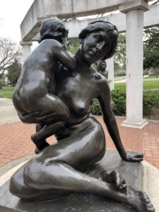
It takes about two miles of walking to see all 80 works in the collection, which are spread around the campus. There is seating and shade available near most works.
One of the best-known works is the “Millie the Millipede” sculpture by Wichita-native Tom Otterness, which sits just south of the Ulrich Museum. Other works include “Love” by Robert Indiana, “Sodbuster: San Isidro” by Luis Alfonso Jimenez and a kinetic sculpture outside the Grace Memorial Chapel by George Rickey.
To help guide you through the walk, the Ulrich offers a free downloadable app as well as a printable map. The app provides information about each sculpture as well. If you’d rather wing it, there are clusters of works around the Ulrich, the Duerksen Fine Arts Center, Morrison Hall, Grace Memorial Chapel and the Ablah Library.
Kylie Cameron